




Aquarius ENC Plotter

Perihal Aquarius ENC Plotter
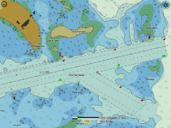
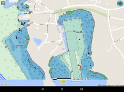
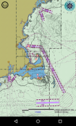
Navigasi menggunakan carta elektronik percuma rasmi yang digunakan untuk penggunaan navigasi. Muat turun secara percuma melalui 1400 Carta Navigasi Elektronik (ENCs) secara terus dari NOAA, atau membekalkan carta yang mematuhi S-57 anda sendiri. ENCs dari NOAA bertujuan untuk penggunaan navigasi, dan setiap carta yang diunduh adalah NOAA ENC® rasmi.
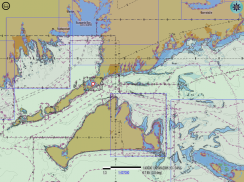
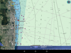
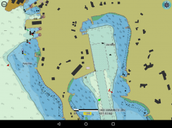
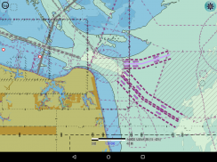
Aquarius menyediakan perancangan ENC yang pantas dan cekap, pada telefon atau tablet anda. Carta berbilang dipaparkan secara serentak untuk kesan panorama yang berterusan di semua peringkat zum.
Ciri-ciri:
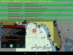
- Memaparkan keadaan cuaca dan laut semasa. Data dari stesen buoy Pusat Data Buoy Pusat (NDBC).
- Ramalan arus pasang dan ukuran paras air. Data dari stesen paras air pasang dan air NOAA.
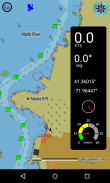
- Lokasi GPS diplot dengan pilihan tiga mod yang berbeza: Mod peta tetap, dan dua mod bergerak-peta (utara atau mana-mana orientasi ke atas, dan kursus). Bearing dan kelajuan di atas tanah dipaparkan. Hidupkan atau matikan untuk menjimatkan bateri.
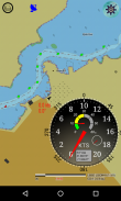
- Resolable, resizable, re-positionable combo-gage untuk paparan maklumat GPS, dalam gaya analog dan digital.
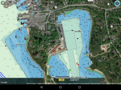
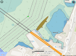
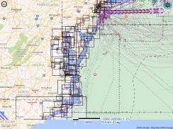
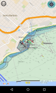
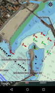
- Pengesahan fakta-pada-tanah. Paparkan ENCs sebagai tindanan pada peta Google. Pilih jubin peta jalan, satelit, atau hibrid. Lihat butiran "kehidupan sebenar" di bawah simbol-simbol, seperti keadaan menonjol kemudahan berperahu dan ciri-ciri lain, pada tarikh imejan. Pergi ke www.appliedvanilla.com untuk melihat video: Aquarius ENC Plotter dengan peta satelit
- Integriti data yang boleh diuji. Carta yang dimuat turun mengekalkan nama dan kandungan fail asalnya, dan boleh dilihat secara bebas.
- Pantas, pemproses ENC-to-Display langsung. Selepas setiap permulaan, Aquarius secara langsung hanya membaca fail rasmi ENC (S-57) yang asli, rasmi di storan peranti anda yang anda letakkan di sana. Aquarius tidak membaca format proprietari atau pangkalan data yang diperolehi. Aquarius bukanlah front-end untuk imej ENC berjubin berasaskan web. Ciri ini meningkatkan kebolehpercayaan rantaian bekalan keseluruhan dengan memendekkannya dengan ketara. Inilah ciri tunggal yang paling penting persaingan tidak mahu anda ketahui, kerana ia menjadikan niche lumayan yang usang usang.
- Permintaan objek maju. Objek dikenal pasti dan ditonjolkan secara individu. Grid latar belakang yang dikalibrasi memudahkan pengukuran. Togol antara mod tunggal-pilih dan pelayaran. Dalam mod pelayaran, hanya pan skrin, dan maklumat untuk objek yang berada di bawah crosshair dipaparkan secara automatik, dengan respons yang tidak keterlaluan. Halaman melalui objek bertindih atau kebetulan.
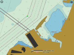
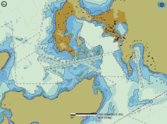
- Tetapkan kedalaman Kontur Keselamatan, dan pilih 2 atau 4 warna untuk skema paparan kawasan kedalaman. Ciri kritikal ini membolehkan anda menyesuaikan paparan ENC ke draf bot anda, untuk mengelakkan asas. Kawasan-kawasan yang lebih ringan pada paparan adalah "selamat" kawasan untuk bot anda. Pembentangan kedalaman juga dipaparkan, tetapi kawasan yang lebih terang-teduh adalah kunci.
- Bahaya terasing dipaparkan secara automatik, menggunakan tetapan Kedalaman Kontur Keselamatan anda.
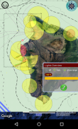
- Gambaran keseluruhan lampu. Pemaparan kawasan luas ringkas bagi semua objek yang menyala (Lighthouse, dll), dengan penglihatan / jarak halo.
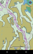
- Perincian yang lebih kemas dan bersih. Symbology gaya pautan rangkaian untuk laluan dan sempadan kawasan. Simbol tidak akan diputarbelitkan di sudut, dan laluan bergerigi lancar diinterpolasi mengikut tahap zum.
- Fail kemas kini ENC diproses, untuk paparan carta yang paling terkini dan tepat.
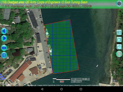
- Membaca carta INC ENC (IENC), seperti mereka dari Kor Jurutera Jurutera (lihat screenshot dengan foto jambatan).
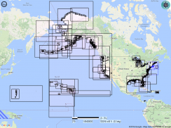
- Paparan grafik katalog carta, untuk muat turun dan paparan. Muat turun carta secara individu atau oleh kawasan khusus terpilih.
- Paparkan hanya carta yang anda pilih, atau biarkan Aquarius secara automatik memaparkan carta semasa anda menyemak imbas.
- Carta tinggal di folder yang anda tetapkan sendiri. Folder individu boleh dihidupkan atau dimatikan sebagai lapisan.
- Kandungan secara percuma; Mod peta bergerak untuk GPS, combo-gage, dan peta Google satelit dan mod hibrid disatukan bersama sebagai pilihan pembelian tunggal.
- Panduan pengguna terbina dalam. Lihat video di laman web pembangun.


